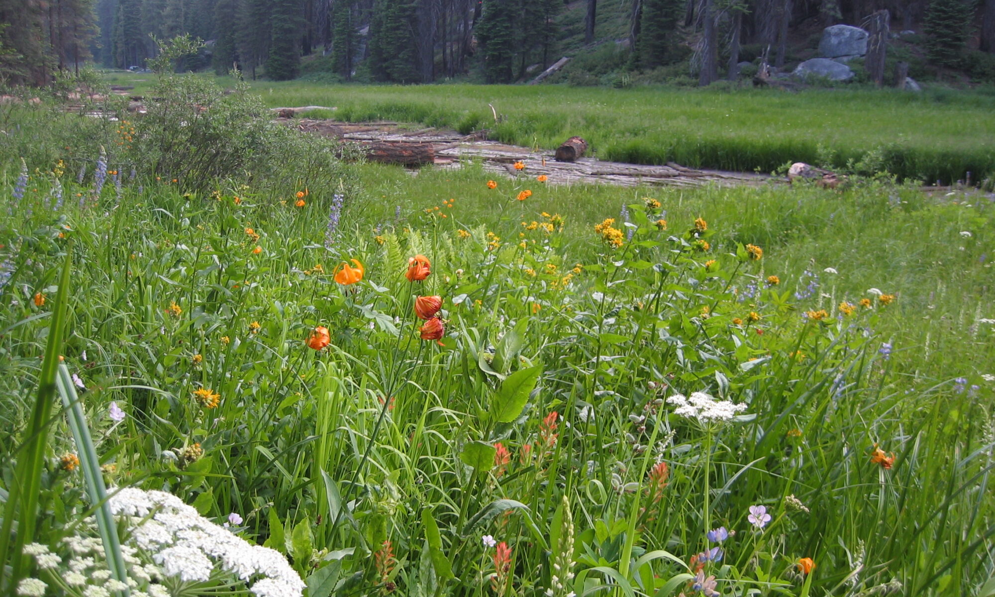


After many years of collaborative field science, lab experiments and analysis, computer modeling, a chapter of my PhD dissertation, and Lydia and Melissa’s Master’s theses, colleagues and I just published a paper describing the continual decomposition of the soil in Tuolumne Meadows. Today’s plant community isn’t productive enough to maintain the high-carbon content of the soil. There’s lots of bare ground in the meadow and very few sedge plants that we’d expect to see in a place like this with such a carbon-rich soil. We grew and transplanted those expected sedges to see if we could restore carbon balance to the meadow. The plants are surviving and growing strong root systems, but haven’t yet spread and become productive enough to stem the loss of carbon. Reversing years of impact and carbon loss is a slow process in short subalpine summers. I’ll revisit Tuolumne Meadows in a few years to check its carbon pulse. Hopefully I’ll find that the plants are growing strong and building back the decades of lost soil. Newsweek wrote a nice piece summarizing our study.
The cows came home
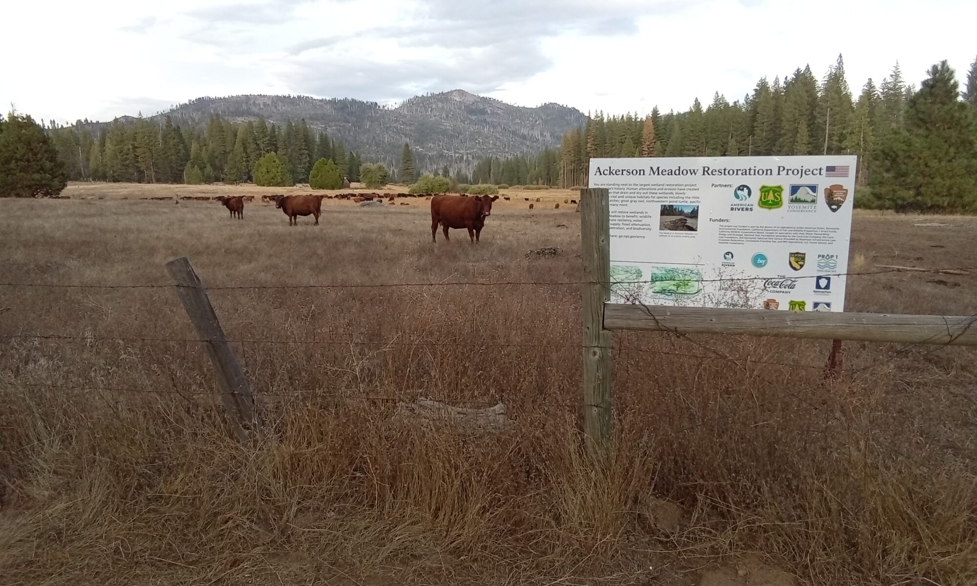
A portion of Ackerson Meadow remains in the Stanislaus National Forest, with an active grazing lease. About 300 cattle are gathered here as part of the fall roundup, calf splitting, and prep for the drive down to winter grounds in the Central Valley.
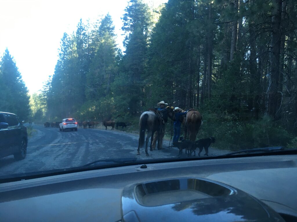
Cowboys and cattle dogs driving cattle down Evergreen Road to Ackerson Meadow. This is part of the longest remaining cattle drive in the state of CA. The calves were separated from their mothers this month, and next month the cows will be herded by horse-mounted cowboys about 50 miles down to their winter pastures in the Central Valley, utilizing highway 120 and its bridges over major rivers for part of the way.
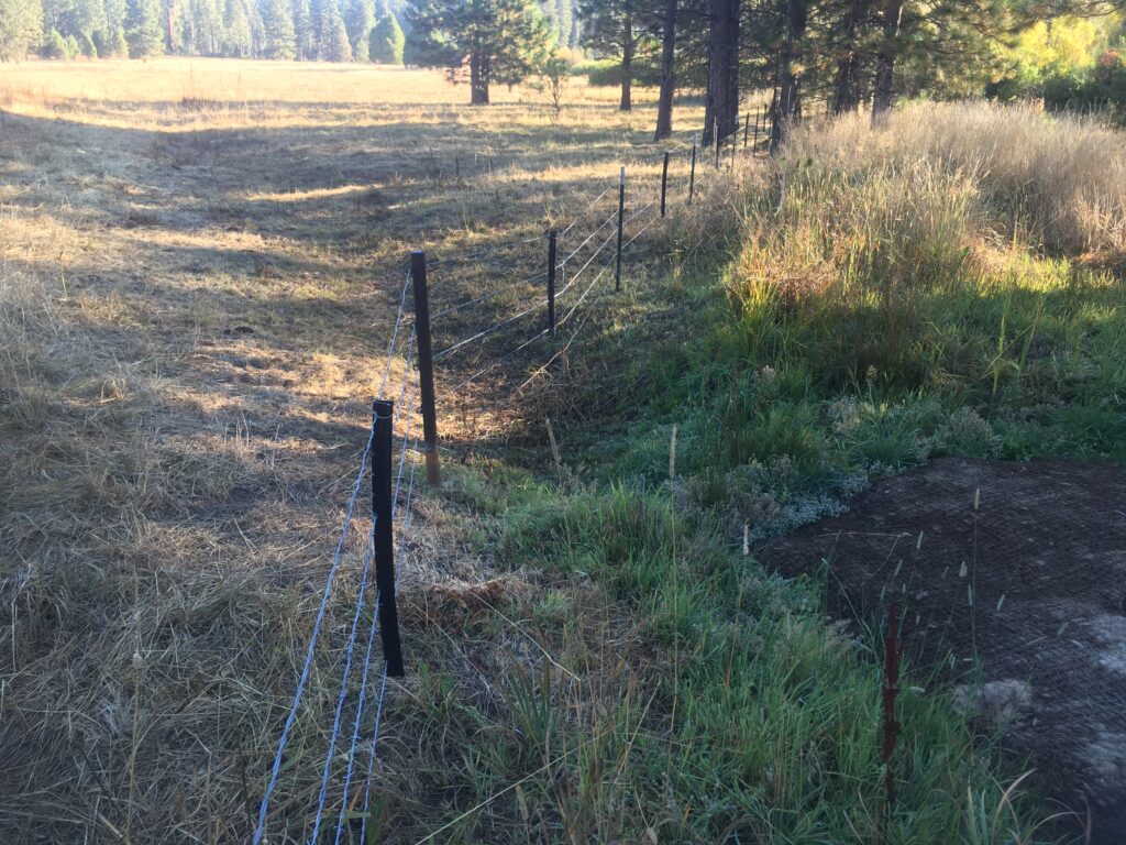
A fence separates the cattle gathering pasture at the left from the wetland restoration project to the right. Cattle will be excluded from the restoration for 3-5 years to allow plants to become densely established. Rewetted portions of unfilled meadow on the right are already thriving with ungrazed plants, whereas the small section of filled gully visible in the lower right is still mostly bare dirt with erosion blanket over it. The pasture to the left has been intensively grazed for a few days. Cattle squeezed their heads under the fence to get at the lush growth on the restoration side.
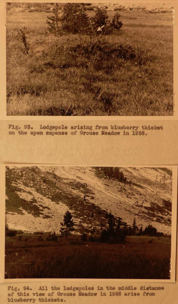
A report on the status, changes, and ecology of back country meadows in Sequoia and Kings Canyon National Parks
Carl W. Sharsmith
CITATION
Sharsmith, C (1959) A report on the status, changes, and ecology of back country meadows in Sequoia and Kings Canyon National Parks. Report to Sequoia and Kings Canyon National Parks. Photographed in Park archives, Three Rivers, CA.
FIGURES 93-94
WRITTEN SUMMARY
Text and low-res images
High-res images
Erosion in the Roaring River District, Kings Canyon National Park: A pictorial review after ten years
Bruce W. Black
CITATION
Black, BW (1952) Erosion in the Roaring River District, Kings Canyon National Park: A pictorial review after ten years. Photographed in Park archives, Three Rivers, CA.
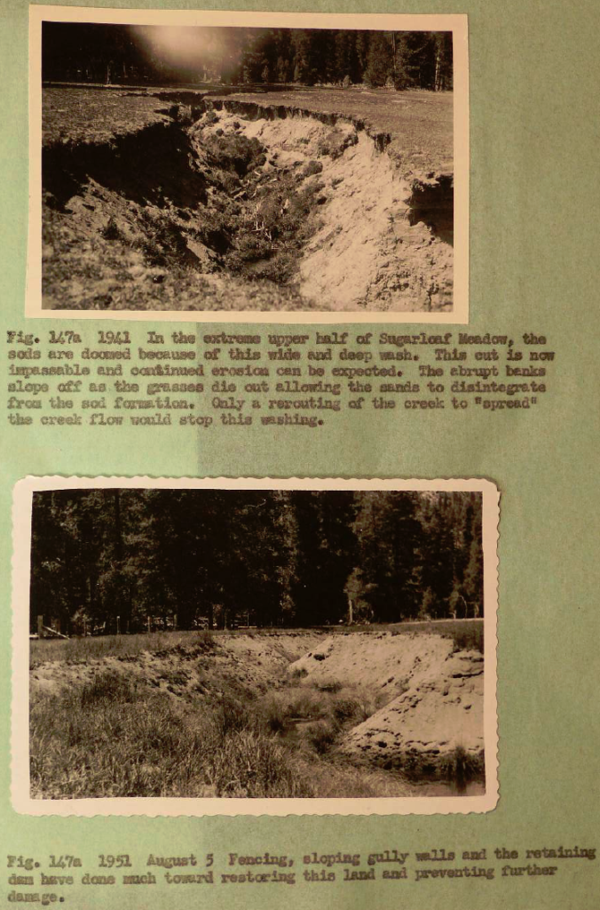
FIGURE 147a
WRITTEN SUMMARY
To: District Ranger Bechtel
From: Ranger Bruce W. Black.
Erosion in the Roaring River Section — A pictorial supplement to ” Study of Grazing Conditions in the Roaring River District, Kings Canyon National Park by: John E. Armstrong, District Ranger, 1941″.
During the 1941 season, John E. Armstrong, then district ranger of the Roaring River District, took certain pictures of grazing conditions and erosion problems then existing in that region and incorporated them in a grazing report. It was your desire to start a series of pictures taken every ten years of certain specified scenes or subjects. The purpose is to maintain a check on changing conditions. Knowledge derived from these comparative photographs will be a valuable guide in the future toward intelligently administering this area. You selected certain photographs from the Armstrong Report and during the 1951 season, I took pictures of the same scenes, so that now we have two series of pictures taken ten years apart. All of the pictures tell their story and the value of this project will increase with the years. Some few places seem to show improvement others appear to have remained static, and in many instances it will be seen that the meadows have suffered and deteriorated in the ten year interval just past. Before and after photographs of Soil and Moisture Conservation projects should prove informative. I have purposely avoided any lengthy commentary as this has been well taken care of in several past reports. Extensive background material covering erosion and grazing can be obtained by reading “A Study of Grazing Conditions in the Roaring River District, Kings Canyon National Park”, April 21, 1942 by District Ranger John E. Armstrong; also the “Special Report on Range Management and Wildlife Protection in Kings Canyon National Park”, May 23, 1941, by Regional Biologist Lower Sumner (especially pp. 189-214). Further information may be gained by reading “Erosion in the Roaring River District, Kings Canyon national Park — A check-up after Six Years”, November 23, 1947, by Regional Biologist Lowell Sumner. Pages four to six, inclusive, of the 1947 report contain a very fine but brief analysis of the problem as it then existed.
Erosion in the Roaring River District, Kings Canyon National Park: a check-up after six years
Lowell Sumner
CITATION
Sumner Jr., EL (1947) Erosion in the Roaring River District, Kings Canyon National Park: a check-up after six years. Report to Sequoia and Kings Canyon National Parks. Photographed in Park archives, Three Rivers, CA.
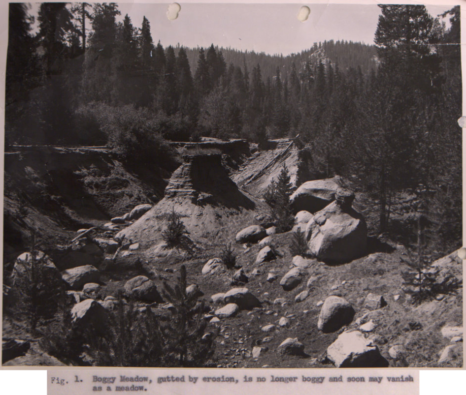
FIGURE 1
WRITTEN SUMMARY
Severe meadow erosion means a lot more than loss of wildlife habitat, or wounding of the esthetic sensibilities. Meadows in Sequoia-Kings with a normal life span of from several hundred to over a thousand years have, within a period of 40 years, been made centuries older by man-caused erosion. Some have been brought by erosion gullies to extreme old age and death.
This is a pictorial report for the benefit of those with limited time for reading. Thereby it avoids the bulk of the 1941 and 1942 reports that first described the destruction of these meadows. These earlier reports gave extensive background material that need not be repeated here. Most complete is “A Study of Conditions in the Roaring River District, Kings National Park, with Recommendations”, April 21, 1942, by District Ranger John E. Armstrong (177 pp., 232 figs.). Also useful is the “Special Report on Range Management and Wildlife Protection in Kings Canyon National Park”, May 23, 1941, by Regional Biologist Lowell Sumner (esp pp. 189-214).
Field studies summarized in the present report were made in the summer of 1947 during a six-week biological survey of Sequoia-Kings Canyon National Parks.
The mountain meadows are the heartlands of the Roaring River District, not only from the standpoint of beauty but of fertility, liveability and practical use of the area. Forty years of ruinous overgrazing have severely depleted the vitality of most of them and have advanced the date of their eventual extinction by centuries. A few are nearly extinct already.
In recent years the Park has secured some improvement in herding methods along the lines recommended in the above-mentioned reports. These improvements seem to have prevented the destruction noted in 1940 and 1941 from becoming a great deal worse by 1947. The expiration in a few years of one of the most seriously abused permits also will ease the situation to some extent, eventually. However, in certain of the meadows the damage is now too far advanced to be cured by improved herding methods alone. And to wait idly until a permit expires could be disastrous.
The water table must be restored, not only to meet the moisture requirements of meadow sod but also to halt further large-scale unnatural replacement of grass by lodgepole forest. The Park, always desperately short-handed, has been unable to undertake this soil and moisture conservation program although the need has been realized for several years. The 1947 drought has intensified the urgency by further weakening the remaining grass roots.
Soil and Moisture Conservation Funds are sorely needed to build check dams and fence the worst gullies.
Special report on range management and wildlife protection in Kings Canyon National Park
Lowell Sumner
CITATION
Sumner Jr., EL (1941) Special report on range management and wildlife protection in Kings Canyon National Park. Report to Sequoia and Kings Canyon National Parks. Photographed in Park archives, Three Rivers, CA.
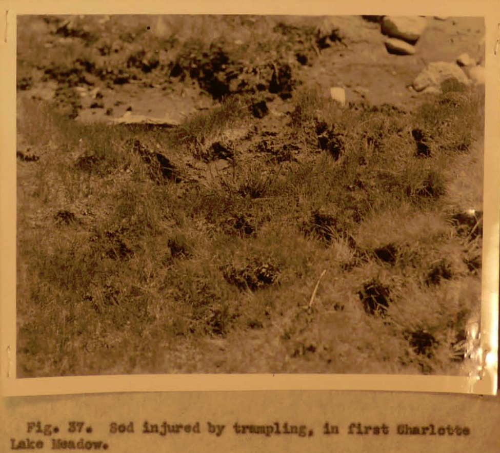
FIGURE 37
WRITTEN SUMMARY
The establishment of Kings Canyon National Park adds the final outstanding unit to the Sierra wilderness system of the National Park service. The new park is not a strictly virgin sanctuary, however. Since 1870 its range lands have been grazed and its wildlife resources depleted and altered – not se drastically as in more accessible regions, but extensively nevertheless.
Sheep have been banned from most of the range lands in recent years, but under inherited grazing permits, a large area in the park still is so closely grazed by cattle that toward fall the traveler can ride all day without finding a place to turn his saddle horse out to feed.
Unlike the Yosemite and the Northern Sierra in general, grazing areas in the high granite country of the Southern Sierra, which includes the Kings, are relatively scarce. Since pack and saddle stock constitute the chief means of transportation, such areas are not only scenically important but vital from a practical standpoint. In addition to the areas which have suffered from commercial grazing, many strategic meadows along the more heavily used recreational trails have suffered severely from overuse by pack and saddle stock.
The present report includes a grazing program designed to:
- Limit damage to the cattle rand and
- Reduce or in most cases eliminate the overuse by pack and saddle stock of strategic meadows along recreational trails.
Handbook of erosion control in mountain meadows
Charles J. Kraebel and Arthur F. Pillsbury
CITATION
Kraebel, CJ and AF Pillsbury (1934) Handbook of erosion control in mountain meadows. USDA Forest Service, California Forest and Range Experiment Station, Berkeley, CA.
FIGURES 25-29
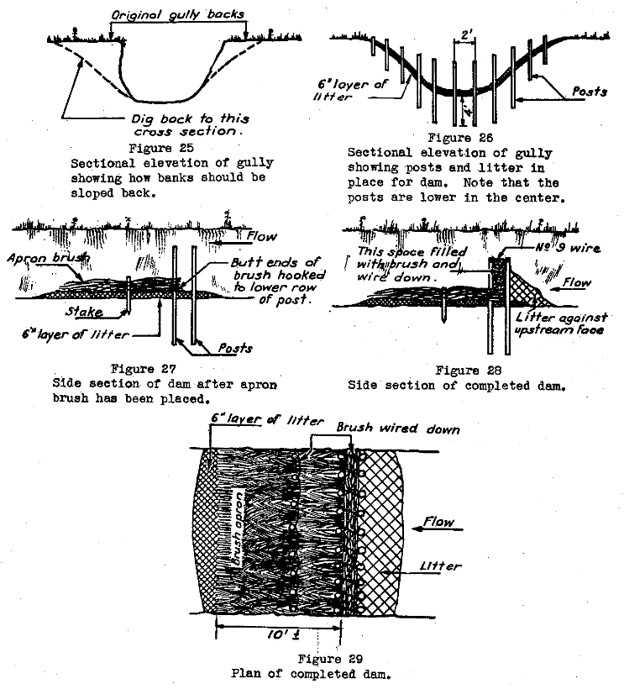
WRITTEN SUMMARY
Control of abnormal or accelerated erosion in mountain meadows is an essential feature of any conservation work on the range lands of National Forests. Mountain meadows can be defined as those open areas vegetated with grasses and sedges kept green through most or all of the summer months by a high water table which offers a constant supply of moisture to the grass roots. Although such meadows compose only a small part of the total area of grazing land, they provide the greater part of the livestock forage through the hot, dry California summers.
Meadow erosion is characterized by sharp active gullies, from one foot to fifty feet or more in width, and from a few inches to ten feet or more in depth, which have cut through old meadows within recent years. Their recent origin, evidenced by their present active operation and by the testimony of ranchers, indicates that the disturbing factor has entered the picture since the advent of the pioneer. These gullies have caused not only a loss of fertile top soil and of meadow area, but, more serious, have drained the meadows by progressive lowering of the water table. With this increasing dryness of the sub-soil, added to the punishment of heavy grazing, the original succulent grasses and sedges gradually disappear and are replaced by less desirable plants such as sage brush and other drought resistant species which may have little or no forage value.