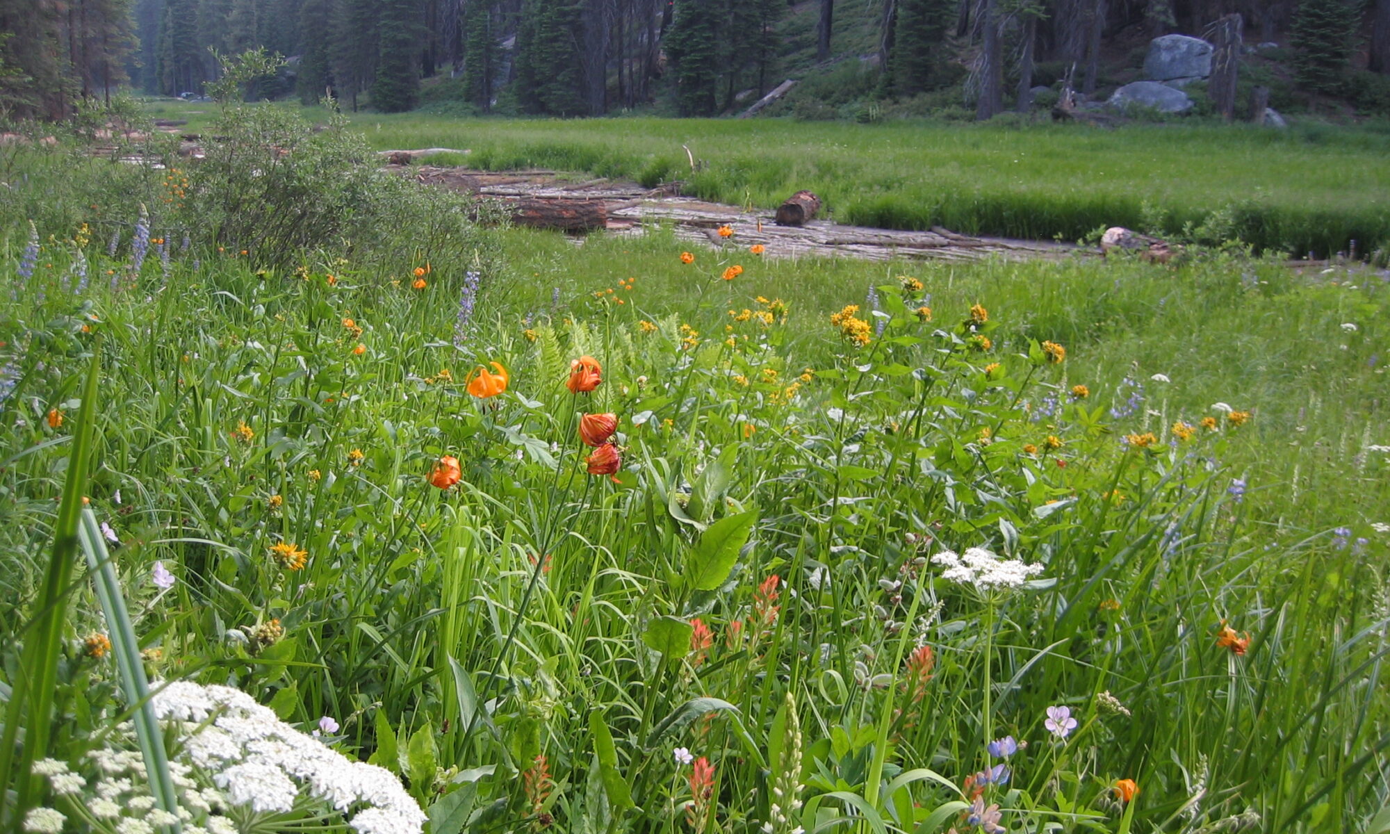
Holocene stratigraphy and chronology of mountain meadows, Sierra Nevada, California

Spencer Hoffman Wood

CITATION

Wood, SH (1975) Holocene stratigraphy and chronology of mountain meadows, Sierra Nevada, California. PhD dissertation, California Institute of Technology, Pasadena, CA

FIGURE 2-1

WRITTEN SUMMARY

Valley-fill deposits, exposed by Twentieth-Century dissection of a number of meadows on the west slope of the southern Sierra Nevada, contain a stratigraphic record strongly affected by secular variations in watershed hydrology during the Holocene. Meadows are situated in low gradient reaches, adequately supported by seepage water, where fine textured materials accumulate under present hydrologic conditions· Meadows do not necessarily owe their origin to glacial modification of drainage. Many meadows have formed in both glaciated and unglaciated valleys by a water table rise in valley-fill deposits.

Ground water in any meadow drainage basin is annually recharged by snowmelt. Significant evapotranspiration by meadow plants causes diurnal fluctuations of growing-season water tables on the order of 0.2 to 0.5 ft and seasonal fluctuations of 2 to 4 ft. Growing-season water-table depths are characteristically different for the two major plant communities, being usually shallower than 2 feet for meadows, and deeper than 4 ft for conifer forests. This relationship and a ground-water model are used to interpret paleohydrologic variations recorded in valley-fill stratigraphy.

Stratigraphy, radiocarbon dating, and tephrachronology indicate the following sequence in upper tributary valleys of the montane belt. Pre-Holocene cobbly alluvium rests upon bedrock. A paleosol developed upon this alluvium between 10,200 and 8700 radiocarbon years B.P., records an early post-glacial climatic interval that established forests in the present upper montane belt. The overlying sequence of coarse loamy materials associated with in situ conifer stumps indicates one or more intervals of good soil drainage and dry valley-bottom conditions between 8700 and 1200 years B.P. At some sites there is an abrupt change from forest soils to overlying wet-meadow deposits dated 2500 years at some sites and 1200 years at others, suggesting many meadows originated coincidentally with neoglaciation in the Sierras. A water-table rise of a few feet, resulting from late melting snows, could cause the change from forest to meadow conditions. Meadow deposits are composed of organic-rich, sandy-loam, topsoil layers intercalcated with sheets of well-sorted sandy gravels deposited by flood flows with recurrence intervals greater than 50 years.

A plot of upstream catchment area and valley gradient for dissected and undissected meadows indicates the geomorphic domain of unstable meadows subject to gully erosion under present hydrologic conditions on the Sierra west slope.
Two pumiceous tephra layers, widespread in meadow topsoils of the southern Sierra, are radiocarbon dated and attributed to tephra-ringed eruptive centers at opposite ends of the Mono-Inyo Crater chain of eastern California. Tephra 1, characterized by sanidine microphenocrysts and Sr content of 215 ppm, erupted 720 years B.P. Distribution of this tephra is confined to a south trending lobe extending 120 miles over the Sierra from the upper San Joaquin drainage to the Little Kern drainage. Trace element analysis of tephra 1 best match those of the tephra-ringed obsidian flow just south of Deadman Creek in the Inyo Craters. Tephra 2, characterized by a lack of microphenocrysts and Sr contents less than 20 ppm erupted from one of the northern Mono Craters eruptive centers. These two tephras appear to represent the most recent explosive eruptions of magma from this 40-km long chain of Holocene volcanoes.
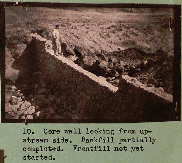
Field trip report – Sequoia Kings Canyon National Park

Fred F. Dickison

CITATION

Dickison, FF (1956) Field trip report – Sequoia Kings Canyon National Park. Report to Sequoia and Kings Canyon National Parks. Photographed in Park archives, Three Rivers, CA.

FIGURE 10
WRITTEN SUMMARY

The land of Sequoia suffered rather extensive damage by the floods of the Christmas season of 1955. These floods, caused by heavy, warm rains on snow, resulted in intensive scouring of all drainage areas. Other damage to trails, roadside drainages, wet meadows, etc., was also extensive. Field observations, with some exceptions, were principally conducted in the Roaring River section of the Kings Canyon area of the Park. Some general reconnaissances were conducted in the Giant Forest district and an intensive survey was made of the Halstead Meadow area of this district.


A study of grazing conditions in the Roaring River District, Kings Canyon National Park

John E Armstrong

CITATION

Armstrong, JE (1942) A study of grazing conditions in the Roaring River District, Kings Canyon National Park. Report to Sequoia and Kings Canyon National Parks. Photographed in Park archives, Three Rivers, CA.

SEE BLACK (1952) FOR PHOTOS

WRITTEN SUMMARY

This report of grazing conditions and related data of the Roaring River District, Kings Canyon National Park, has come through the trials of observation, investigation, and research; it is tempered by adequate deliberation and consultation. The writer has done everything possible to make this survey a pertinent contribution to Park land and grazing management. Repeated emphasis upon destructive grazing practices may help to alleviate the unnecessary drains upon a Nature which has been so lavish to start with, and which throughout our misuse, has been so forgiving and patient to heal the wound made by heedless human usage.
Much credit is due to Mr. E. Lowell Sumner, Regional Biologist, who has given so freely of his time and encouragement.
Indebtedness is owed to all the cattle permittees and their riders, as well as to Ranger Paul Richards who helped with setting up the sample plots at Quartz Meadows.
Mr. Lee Lowery of Visalia, who was the first man to take cattle to Rowell Meadows, gave some interesting and helpful historical facts.
This entire work could well be dedicated to the patient help of Mrs. Armstrong who did all the errands, weighed the grasses and was general secretary and statistician throughout. However, it is more fitting to enshrine the soils and forage of Roaring River. To them then – to their preservation, reestablishment and most efficient utilization – this effort is dedicated.


Special report on range management and wildlife protection in Kings Canyon National Park

Lowell Sumner

CITATION

Sumner Jr., EL (1941) Special report on range management and wildlife protection in Kings Canyon National Park. Report to Sequoia and Kings Canyon National Parks. Photographed in Park archives, Three Rivers, CA.

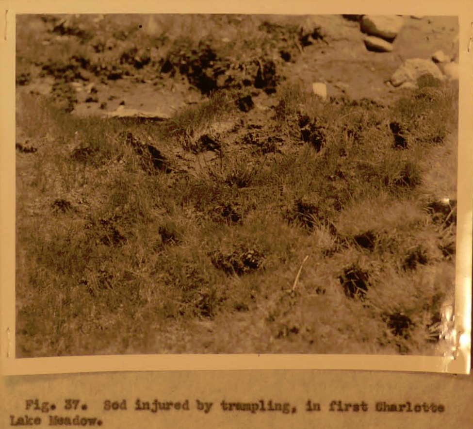
FIGURE 37
WRITTEN SUMMARY

The establishment of Kings Canyon National Park adds the final outstanding unit to the Sierra wilderness system of the National Park service. The new park is not a strictly virgin sanctuary, however. Since 1870 its range lands have been grazed and its wildlife resources depleted and altered – not se drastically as in more accessible regions, but extensively nevertheless.

Sheep have been banned from most of the range lands in recent years, but under inherited grazing permits, a large area in the park still is so closely grazed by cattle that toward fall the traveler can ride all day without finding a place to turn his saddle horse out to feed.

Unlike the Yosemite and the Northern Sierra in general, grazing areas in the high granite country of the Southern Sierra, which includes the Kings, are relatively scarce. Since pack and saddle stock constitute the chief means of transportation, such areas are not only scenically important but vital from a practical standpoint. In addition to the areas which have suffered from commercial grazing, many strategic meadows along the more heavily used recreational trails have suffered severely from overuse by pack and saddle stock.

The present report includes a grazing program designed to:

  1. Limit damage to the cattle rand and
  2. Reduce or in most cases eliminate the overuse by pack and saddle stock of strategic meadows along recreational trails.